
Kinnaur
A dramatic transition zone between lush pine slopes and high-altitude desert, defined by deep gorges, ancient temples, and the towering Kinner Kailash massif.
Kinnaur At A Glance
Kinnaur is a dramatic, high-altitude district in Himachal Pradesh known for its sheer rock faces, deep gorges carved by the Sutlej river, and a seamless blend of Hinduism and Buddhism. Lower Kinnaur features lush apple orchards and dense pine forests, while the upper regions transition into an arid, rugged terrain that once served as a vital corridor on the old Hindustan-Tibet trade route. The Baspa Valley, often considered one of the most beautiful in the Himalayas, offers a slower, more culturally immersive experience defined by distinct Kath Kuni (wood and stone) architecture. Travelers come here for the legendary NH5 road journey, ancient wooden temples like Mathi in Chitkul, and the unique syncretic culture of villages like Kalpa and Sangla. It is a stunning precursor to the higher trans-Himalayan deserts.
Kalpa
Drive along the legendary NH5, an engineering marvel carved directly into sheer rock faces above the Sutlej river. It is considered one of the most dramatic and treacherous mountain roads in the world.
Sangla
The largest village in the Baspa Valley, surrounded by pine forests, apple orchards, and the Bering Nag Temple.
An adventurous loop route entering from the north via Kinnaur. Requires Kinnaur Pass to be open (late June to October).
Chitkul
-
Cellular Networks: BSNL post-paid works reliably in Kinnaur; Jio 4G covers Kinnaur and Kinnaur with periodic blackouts. No coverage in remote homestays (Kinnaur/Pin).
-
Medical Infrastructure:Primary health centers available in Reckong Peo. Severe emergencies require evacuation to Shimla.
-
Cash Economy:ATMs available in Reckong Peo and larger towns. Carry cash for remote villages like Chitkul and Nako.
The 12-Month Kinnaur Cycle
Walk through terraced orchards that produce some of India's finest apples. Experience the seasonal shift from spring blossoms to the bustling autumn harvest.
Spring thaw. Valleys begin to turn green, though upper reaches remain cold. A quiet shoulder season.
Apple blossoms bloom across the valleys. Excellent weather for village walks and photography. The primary season begins.
Lush green valleys, roaring rivers, and clear views of the Kinner Kailash massif. Ideal for exploring Chitkul and the Baspa Valley.
Lower Kinnaur experiences monsoon showers which can cause landslides on NH5. Upper Kinnaur sees less rain but still requires cautious travel.
Crisp, clear autumn days. The apple harvest is complete, and the valleys turn golden before the winter freeze sets in.
Experiences Shaped by the Gorges
Kinnaur is defined by its deep river gorges, terraced apple orchards, and a unique syncretic culture blending Hinduism and Tibetan Buddhism.
The Hindustan-Tibet Road
Navigate the legendary NH5, an engineering marvel carved into vertical rock faces above the roaring Sutlej river.
Baspa Valley Villages
Explore the slow-paced life in Sangla and Chitkul, characterized by ancient wooden architecture and traditional Kinnauri culture.
Syncretic Temples
Witness the unique blend of Hinduism and Buddhism in ancient temples, featuring intricate wood carvings and slate roofs.
Apple Orchards & Harvest
Walk through vibrant apple orchards in lower Kinnaur, especially during the autumn harvest season.
Kinnaur Places Across Kinnaur
Each hamlet and monastery holds distinct microclimates, geological strata, and historical context.

Kalpa
Famous for its stunning, close-up views of the Kinner Kailash range and its ancient Hindu-Buddhist temples.

Sangla
The largest village in the Baspa Valley, surrounded by pine forests, apple orchards, and the Bering Nag Temple.
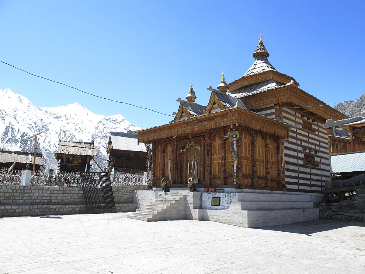
Chitkul
The last inhabited village near the Indo-Tibet border, offering pristine views and a raw Himalayan atmosphere.
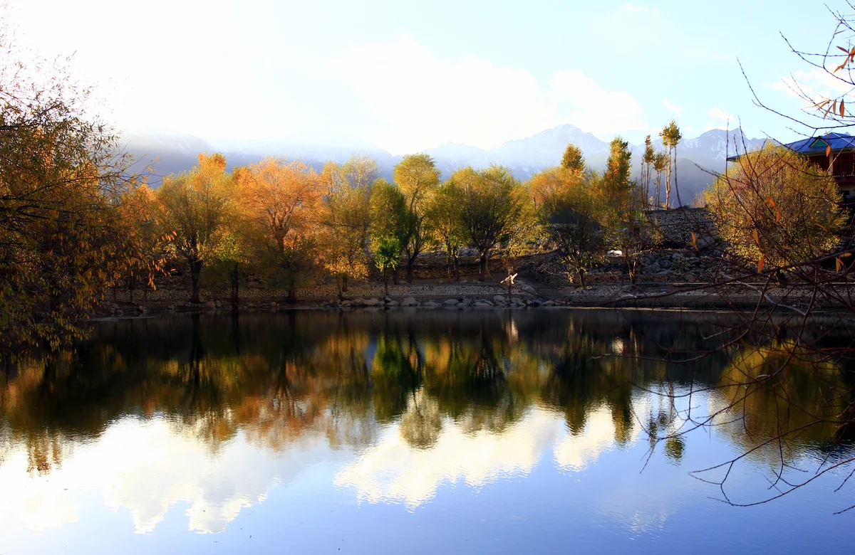
Nako
A high-altitude village with a serene lake, functioning as the transition point between Kinnaur and Kinnaur.
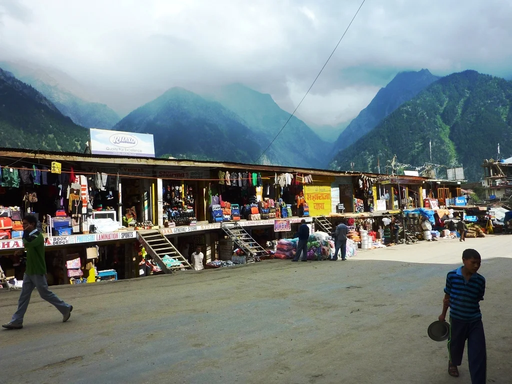
Reckong Peo
The administrative center of Kinnaur, providing essential services, permits, and panoramic views of Kinner Kailash.
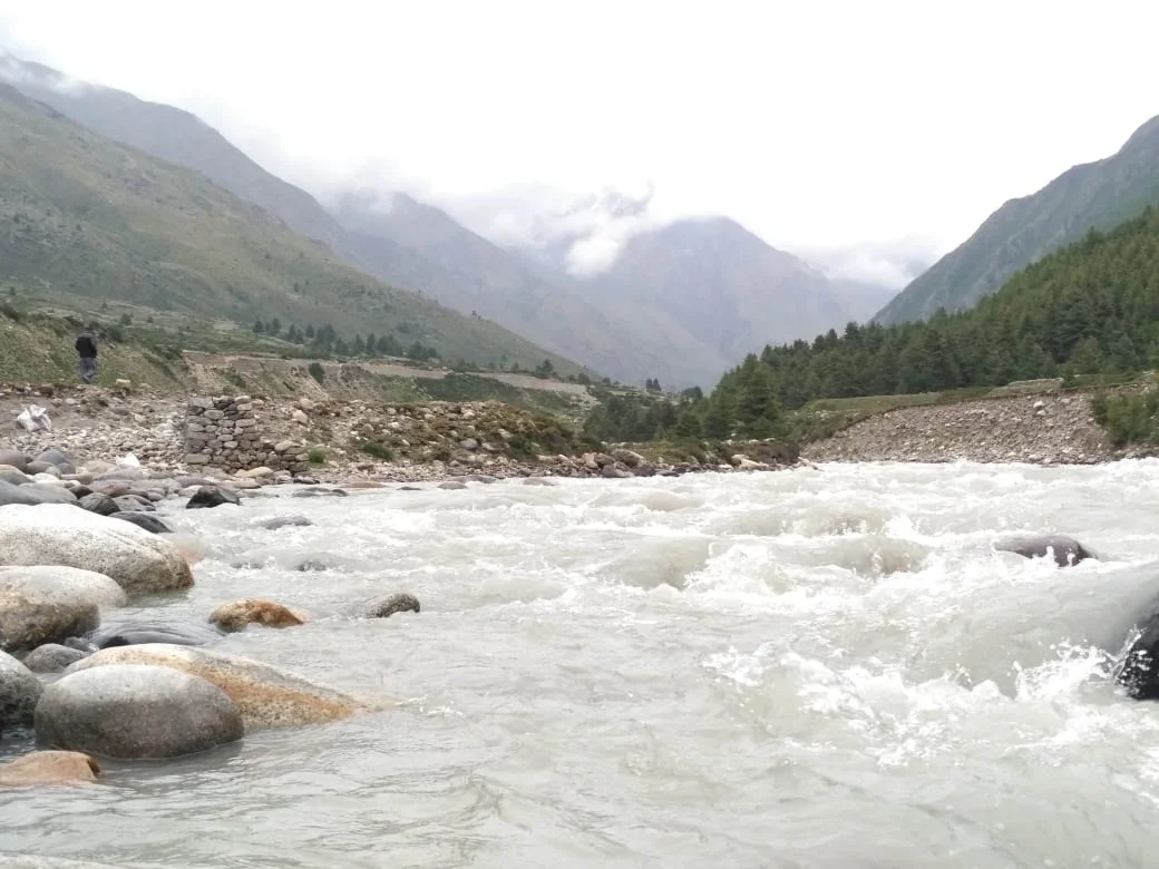
Baspa River Trails
Scenic walking trails along the Baspa River, perfect for slow exploration and nature immersion.
Structured Kinnaur Circuits
Field-tested itineraries navigating Kinnaur's river gorges and orchard valleys, designed with deliberate elevation gains and mountain road pacing.
The Kinnaur Valley Circuit
A comprehensive journey through Kinnaur's highlights, from the dramatic gorges of NH5 to the apple orchards of Kalpa and the border hamlet of Chitkul.
Baspa Valley Slow Travel
A relaxed itinerary focusing entirely on the forested Baspa Valley: stay in riverside homestays in Sangla, walk pine trails to Batseri, and experience Chitkul at a slow pace.
Upper Kinnaur & Nako Lake
Ascend from lush apple valleys into the trans-Himalayan transition zone: visit the ancient monastery village of Nako and Kalpa's terraced orchards facing Kinner Kailash.
What is Kinnaur actually good for?
Kinnaur is a dramatic, high-altitude district in Himachal Pradesh known for its sheer rock faces, deep gorges carved by the Sutlej river, and a seamless blend of Hinduism and Buddhism. Unlike the barren landscapes of Spiti, lower Kinnaur features lush apple orchards and dense pine forests, while the upper regions transition into an arid, rugged terrain. The Baspa Valley, often considered one of the most beautiful in the Himalayas, offers a slower, more culturally immersive experience. Travelers come here for the legendary NH5 road journey, ancient wooden temples, and the unique syncretic culture of villages like Kalpa and Sangla. It is best suited for cultural explorers, slow travelers, and those comfortable with challenging mountain roads. It is a stunning precursor to the higher trans-Himalayan deserts, offering a bridge between the green hills of lower Himachal and the stark high-altitude desert. Expect spectacular views of the Kinner Kailash range, deep immersion in local customs, and an environment that demands both respect and patience. It is an amazing place that truly rewards those with an adventurous spirit and a love for high mountain cultures, far removed from standard tourism.
Practical Ground Reality
Kinnaur is accessed primarily via NH5 from Shimla. The roads are notoriously narrow and carved into cliffs, requiring experienced drivers. Public buses and private taxis are available. Accommodation ranges from basic guesthouses to comfortable homestays, especially in Sangla and Kalpa. Inner Line Permits are required for foreign nationals traveling beyond Reckong Peo towards Kinnaur. Cellular connectivity is decent in major towns (BSNL and Jio) but weak in remote areas. ATMs are limited beyond Reckong Peo.
Kinnaur Field FAQ
Direct, pragmatic answers to questions travelers ask before embarking.
Ready to Shape Your Kinnaur Expedition?
No automated generic itineraries. Speak directly with route specialists who monitor daily snowfall, road clearance reports, and homestay capacities across the valley.