
The road is part
of the journey.
In the high Himalaya, the road is not a transit inconvenience between destinations. It is the defining theatre of shifting geologies, rock-carved highway ledges, changing oxygen levels, and untamed glacial rivers. Here, the vehicle is merely an observation chamber through epochs of folding earth.
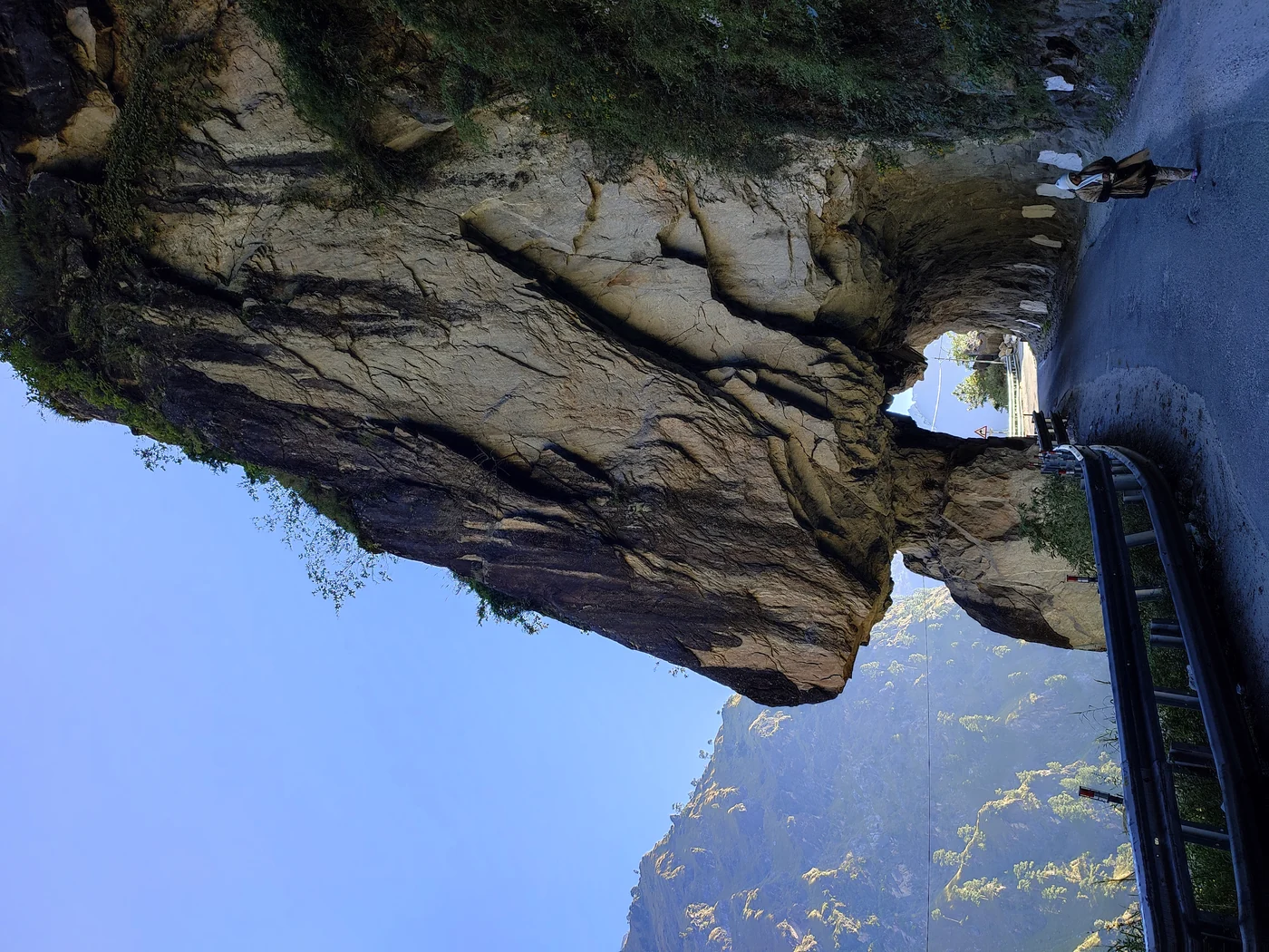
Carved directly through precipitous gneiss and quartzite overhangs.
Cartographic Note: High altitude routes undergo constant morphological changes due to freeze-thaw cycles. Never rely on automated satellite turn-by-turn navigation apps past Reckong Peo.
Safe Altitude Acclimatization By Road
The counter-clockwise ascent from Shimla safeguards the human pulmonary vascular bed. By staging sleeping elevations below 500m increments per 24 hours, travellers cross Kunzum Pass without debilitating Acute Mountain Sickness (AMS).
Shimla ──→ Sangla
Tarmac gives way to Sutlej canyon. Passing through Rampur Bushahr into apple-rich Kinnaur. Safe sleeping at 2,680m.
Kalpa ──→ Tabo
Crossing Malling Block and the confluence of Spiti and Sutlej rivers at Khab. Passing Indian Army Sumdo Inner Line checkpoint.
Tabo ──→ Kaza High Hub
Short transit day allowing exploration of Dhankar cliff monastery, Langza fossil beds, and Hikkim post office.
Kaza ──→ Manali
Navigating Losar, summiting Kunzum Pass (4,550m), traversing the boulder-heavy Batal gravel beds, and descending via Atal Tunnel.
Why mountain roads defy ordinary touring logic.
In plains travel, distance dictates time. In the high western Himalaya, geology, glacial melt, road clearance, and driver psychology determine survival and serenity.
Pagol Nallahs & Glacial Melt Timers
Himalayan streams are not static. During morning hours (06:00 to 10:00), stream beds like Chhota Dhara run shallow. By 14:00, midday sun melts high glacier snouts, converting dry gravel beds into churning torrents capable of sweeping low vehicles. Overland routing demands sunrise starts.
Acclimatization by Gradual Wheel
Commercial flights into high altitude drop travellers instantly into 3,500m rarefied air, shocking red blood cell production and risking pulmonary edema. Driving through the Sutlej valley grants the body 48 to 72 hours of calibrated, incremental oxygen thinning that naturalizes arterial pressures.
Local Mountain Pilots, Not City Drivers
An urban driver looks at the tarmac. A Kinnauri or Spitian driver watches the mountain face above, reading minor pebble sprinkles that herald active rockfall, judging mud cohesion, and understanding differential axle placement on loose shale ledges. We only deploy native hill drivers.
Three iconic mountain corridors.
Every route is documented with authentic road surfaces, clearance thresholds, transit duration, and verified seasonal openings.
The Hindustan-Tibet Border Highway (Shimla to Spiti)
Originally forged by Lord Dalhousie in 1850 as a trade artery connecting British India to Western Tibet. Today, this is the most philosophically complete Himalayan journey. Beginning in Shimla's cedar ridges, it dives into the granite canyons of Kinnaur, skirts the Tibetan frontier at Khab, and climbs into the moonscapes of Spiti before exiting through Rohtang's modern tunnel.
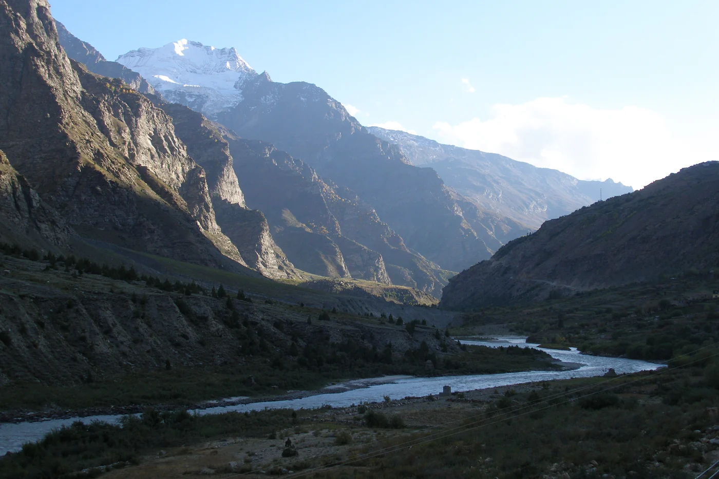
The Manali-Leh Military Highway Corridor
474 kilometers of high mountain desert traversing five monumental passes: Rohtang (or Atal Tunnel bypass), Baralacha La, Nakee La, Lachung La, and Tanglang La (5,328m). This route is unforgiving. No commercial settlements exist between Jispa and Upshi for over 250km, requiring absolute mechanical self-sufficiency and strict altitude pacing.
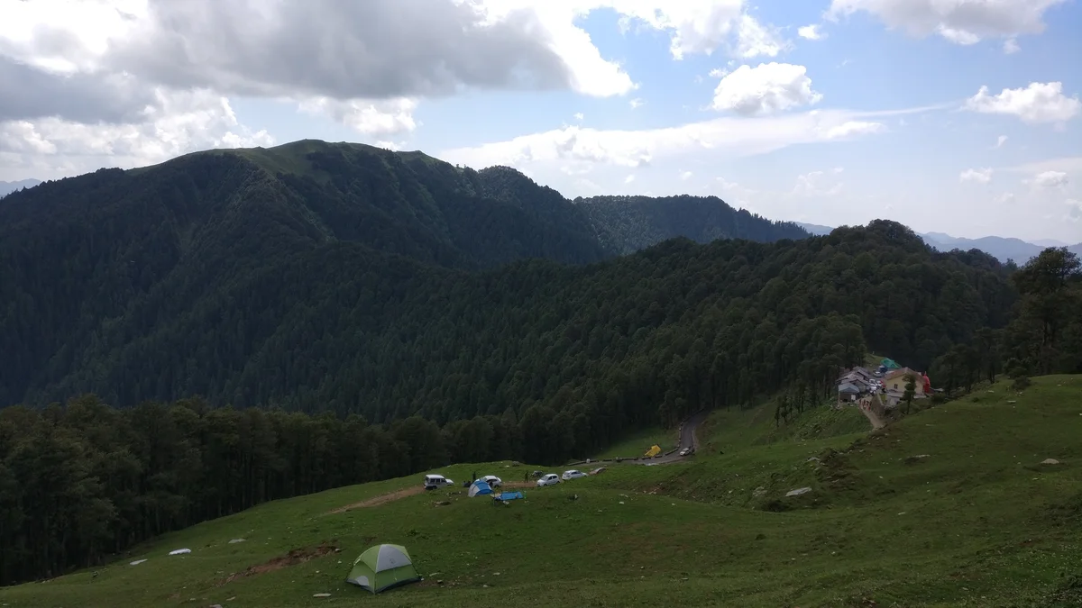
Tirthan & Jalori Pass Secret Linkage
A quiet, lesser-known mountain traverse that cuts across the Seraj ridge between Shimla and the Great Himalayan National Park. Featuring legendary 30% hairpins through dense Himalayan cedar and silver fir forests, this drive avoids highway madness and terminates beside the crystal-clear trout waters of the Tirthan River.
The non-negotiable rules of high Himalayan driving.
Himalayan roads do not forgive optimism. An under-cleared oil sump can crack on a rogue granite boulder 150 kilometers from the nearest workshop. Here is how our expedition fleets are architected.
Why low hatchbacks and city sedans fail
Typical sedans feature 150-165mm clearance. Between Batal and Gramphoo, road stones reach 180-220mm height. A broken sump or ruptured fuel line leaves vehicles stranded in sub-zero passes with zero cell signal.
Golden Rule: Zero night transit under any pretext
All vehicles in our network must reach camp/homestay before sundown (17:30 - 18:30). Black ice forms invisibly on wet corners at twilight, and sudden debris slips from unmonitored slopes cannot be detected by headlights.
Fuel Ledger: Kaza's isolated lifeline
Kaza holds the world's highest commercial fuel station (3,800m). Beyond Kaza toward Manali, there is zero fuel for 200+ km until Tandi. We ensure all vehicles carry reserve jerry cans for unpredicted diversions.
| Sector Waypoint | Elevation | Fuel / Mechanics | Cell Signal |
|---|---|---|---|
| Shimla | 2,276m | Plentiful | All Networks 5G |
| Rampur Bushahr | 1,005m | Full Service Dealerships | All Networks 4G |
| Reckong Peo / Kalpa | 2,290m | Last Major Mechanics | Jio & Airtel 4G |
| Puh / Spiti Confluence | 2,830m | Indian Army / Limited | BSNL Only |
| Tabo Monastery Town | 3,280m | Zero Fuel Pumps | BSNL / Intermittent Jio |
| Kaza (District Capital) | 3,800m | Highest Retail IOCL Pump | Jio / BSNL 4G (Variable) |
| Losar & Kunzum Pass | 4,550m | Zero Facilities | Zero Signal (Blackout) |
| Batal / Chhota Dhara | 3,960m | Chacha-Chachi Dhaba (Shelter) | Zero Signal (Blackout) |
| Tandi Confluence | 2,570m | Crucial Refill Station | All Networks 4G |
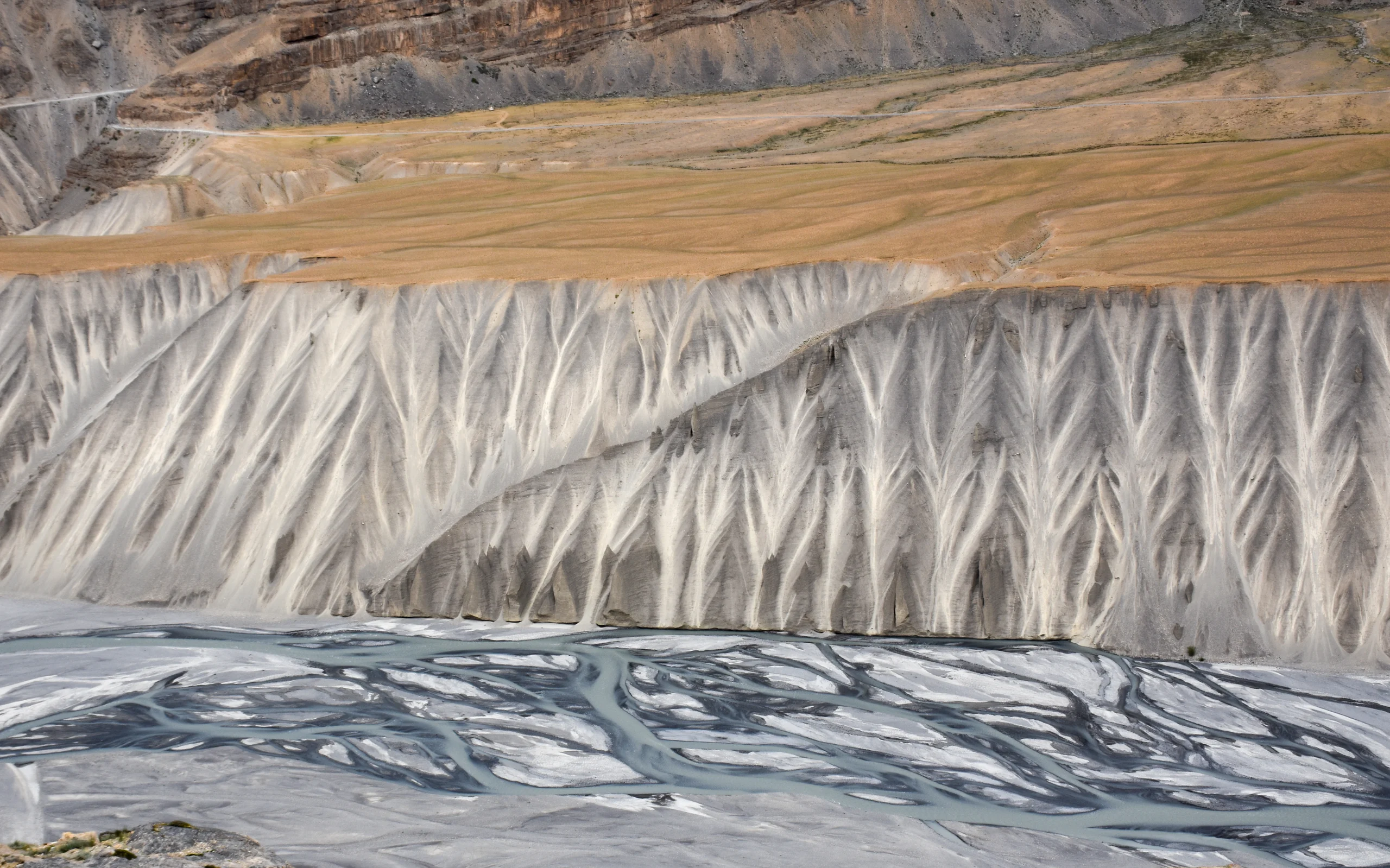
The Cold Desert Loop: Shimla to Manali via Kinnaur
Our gold-standard 9-day road circuit. Designed with native Kinnauri and Spitian chauffeur guides, private mountain-spec SUVs, carefully spaced homestay rests, and real-time mountain pass weather clearance.
9D / 8N
Unhurried
Chandigarh
Frequently asked overland questions.
Honest, practical field advice without commercial varnish.
Can I self-drive my own city car on the Spiti loop?
From Shimla to Kaza via Kinnaur, the road is 70% tarmac and manageable with careful driving in a standard car. However, the stretch between Losar, Kunzum Pass, and Gramphoo (Manali side) is a punishing river-bed moraine with deep water crossings. Low-slung vehicles risk scraping oil sumps or getting high-centered. An SUV with over 200mm clearance is strongly advised.
What inner-line permits are required for the border road?
Indian Citizens: No inner-line permit is required for the standard Spiti Loop (Shimla-Kinnaur-Kaza-Manali), though valid photo identity (Aadhaar/Passport) must be stamped at the Sumdo checkpost.
Foreign Nationals: An Inner Line Permit (ILP) is legally mandatory for the stretch between Jangi (Kinnaur) and Tabo (Spiti). We arrange this at the District Magistrate offices in Shimla or Reckong Peo.
How do we handle motion sickness on continuous switchbacks?
Himalayan mountain roads feature thousands of consecutive curves. We minimize nausea by limiting driving stints to maximum 2-hour intervals, utilizing front-facing high-visibility seating in spacious vehicles (Innova Crysta / Fortuner), avoiding stuffy sealed cabins with mountain air circulation, and carrying ginger tincture and dimenhydrinate protocols.
What happens if a major landslide blocks our route?
Our field planners maintain direct radio and WhatsApp contact with Border Roads Organisation (BRO) command posts. If a sector faces active clearance delays exceeding 4 hours, our drivers automatically execute pre-mapped fallback accommodations in safe valley nodes (such as Sangla or Kalpa) without rushing forward into danger zones.
Ready to map your overland journey?
Speak with our route planners in Shimla and Manali. We will review your travel dates against mountain water crossings, assign a veteran hill chauffeur, and pace your driving hours safely.